
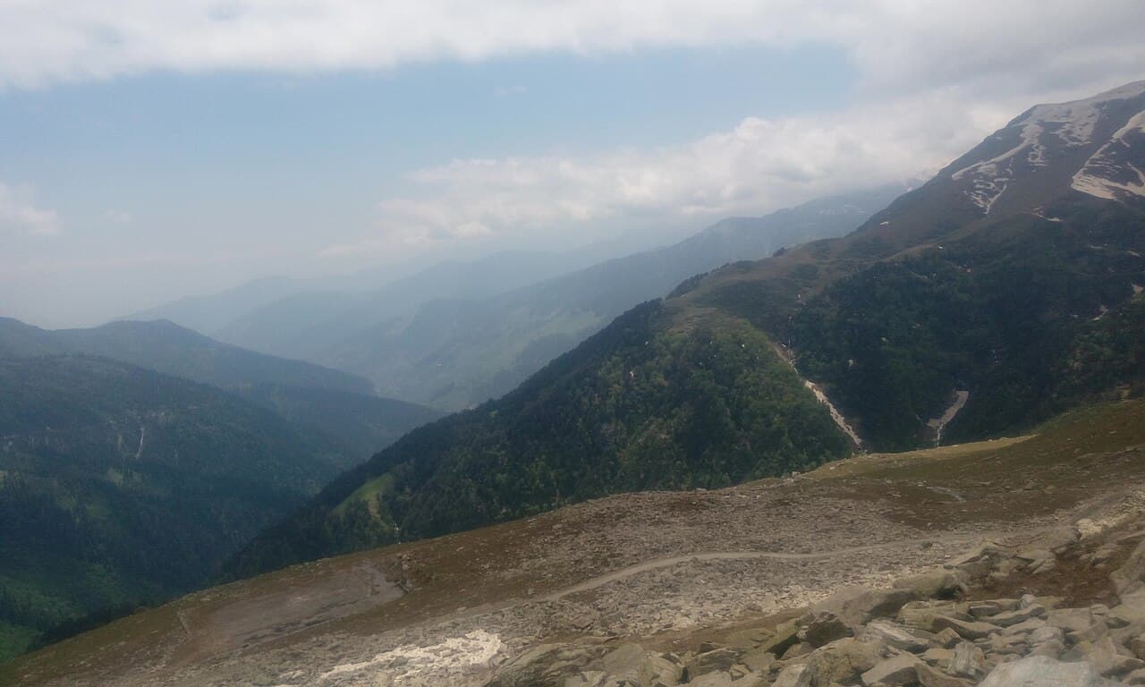
Sach Pass sits at about 4,420 m on the road from Chamba to Pangi Valley. It usually opens between June and early July and stays passable until around mid-October, depending on snow. The crossing from Bairagarh to Killar is roughly 76 km of rough, partly unpaved mountain road with water crossings. Go in a high-clearance SUV or 4x4, start early, and confirm the road status the day before.
We run the Sach Pass route out of Dalhousie as one of our off-road trips, toward Pangi and on to Udaipur in Lahaul. It's the most beautiful drive we do. It's also the one where planning matters most, because the pass decides your dates, not the other way round.
When does Sach Pass open?
There's no fixed date. The pass closes with the first heavy snow, usually by late October or November, and stays shut through winter. In spring the road department clears it, and the opening has landed anywhere from June to early July in recent years. A late snowfall can push it back by weeks.
- June to early July: often the opening window. Expect snow walls and slush near the top.
- July to September: open, but monsoon rain makes streams swell and the road muddy.
- Late September to mid-October: the steadiest weather, and the last window before winter.
Because the dates move every year, we don't confirm a Sach Pass trip until we know the road is open, and we keep a buffer day in the plan.
The route from Dalhousie
From Dalhousie you drop down to Chamba, then follow the road up the valley through Tissa to Bairagarh, where the real climb starts. One widely shared route profile, counted from Chamba, looks like this:
- Tissa: about 63 km
- Bairagarh: about 90 km, around 2,800 m
- Satrundi: about 106 km, around 3,400 m
- Sach Pass: about 120 km, around 4,420 m
- Bagotu: about 130 km, around 3,600 m
- Killar (Pangi): about 166 km, around 2,590 m
Look at the altitudes. From Bairagarh you climb roughly 1,600 m to the top and then drop about 1,800 m to Killar, in one day.
What is the road actually like?
Paved up to Bairagarh, then it gets steadily worse. Above Satrundi the track is narrow, broken and gravelly, and in places there isn't much of a road at all. Snowmelt streams (nallahs) cross it. They're lowest in the morning and rise through the afternoon as the sun melts more snow, which is the main reason everyone on this route starts at first light.
This isn't a drive for a sedan or for someone new to mountain roads. We use SUVs and camper vans with drivers who have done the crossing many times, and they'll stop and walk a stream before taking the car through it.
Do you need a permit for Sach Pass?
Recent travel guides say Indian nationals don't need a special permit to cross Sach Pass into Pangi. We haven't found an official notice that settles it, and local rules on vehicle registration and timings can change from season to season. We check the current rules before every trip, so you don't have to.
Altitude: take it seriously
You go from about 2,800 m to 4,420 m and back down in a few hours. Most people feel nothing worse than a headache at the top, but don't linger there for long. Drink water, skip alcohol the night before, and tell your driver straight away if someone feels dizzy or sick. Descending is the fix, and on this route the descent is right there.
What to carry
- Warm layers and a windproof jacket, even in July
- Waterproof shoes; you may step into a nallah
- Snacks and water for the day; there's little on the way between Bairagarh and Killar
- Cash, and any medicines you need, since shops in Pangi are few
How we plan a Sach Pass trip
We usually run it as part of a longer loop: Dalhousie, over Sach Pass to Pangi, then on toward Udaipur and Manali, or the same route in reverse. You can see the full routes in our Dalhousie to Manali via Sach Pass and Manali to Dalhousie via Sach Pass trips. Camping is possible on these routes for anyone who wants it.
Starting from the plains? Read Pathankot to Dalhousie by taxi, spend a day on Dalhousie and Khajjiar to get used to the hills, then head for the pass. Or tell us your dates and we'll tell you honestly whether the pass is likely to be open.
Altitudes and distances come from published route guides and news reports (for example Wikipedia, The Tribune and Discover with Dheeraj). Sources differ by a few metres and kilometres; conditions on the day always win.